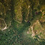
The Spatial Analysis Lab of the Montana Natural Heritage Program and the University of Montana invite applications for a postdoctoral researcher to assist in developing methods for measuring biodiversity indicators using National Ecological Observatory Network (NEON) field and Airborne Observatory Platform datasets collected at eight sites along a latitudinal gradient in US temperate, broadleaf and mixed forests. The mapping products will be integrated with broader scale environmental variables for predictive hotspot modeling and testing controls on macroscale patterns. The successful postdoctoral candidate must be committed to developing leadership, outreach and collaborative project management skills.
This assignment is an opportunity to develop and share expertise in processing large ecological and remote sensing datasets, and applying quantitative models to analyze spatial data. Digital image processing and data integration duties include 1) optimizing spectral and structural variation metrics for predicting baseline biodiversity attributes, 2) addressing challenges associated with cross-track illumination, steep terrain, and scaling sensitivities, and 3) building a Geographical Information System that combines NEON site-level biodiversity products with additional ground-based occurrence datasets and satellite observations. The selected candidate will be responsible for developing and adhering to a detailed data management plan in coordination with the Principal Investigator. As part of this plan the postdoctoral researcher will create a dedicated website for housing data products for public access.
Independent research will be encouraged through progress reviews where complimentary research questions can be developed in the pursuit of additional collaborative funding with new or established partners. The postdoc will be expected to participate in and occasionally lead cross-institution meetings and develop workshop elements that have been designed to bridge gaps between ecology and remote sensing faculty at primarily undergraduate institutions. The successful candidate will play an active, leading role in preparing publications stemming from this work; attend technical training workshops; and present research at seminars and conferences (local, regional and international).
The University of Montana is an Affirmative Action/Equal Opportunity employer and has a strong institutional commitment to the principle of diversity in all areas. In that spirit, we are particularly interested in receiving applications from a broad spectrum of qualified people who would assist the University in demonstrating its essential values of innovation and creativity, impact, diversity and leadership.
Position Details
- The position is funded through the University of Montana under a 12-month Letter of Appointment and includes a competitive salary and comprehensive benefits package (i.e., MUS health insurance benefits, mandatory retirement plan, partial tuition waiver, and wellness program. The position has a solid 12 to 15 months of funding, with opportunity for extension or transition into a staff position.
- Work will primarily be performed at the Spatial Analysis Lab, on the University of Montana campus in Missoula, MT.
Required Qualifications
- Applicants should hold a PhD in ecology, geoscience or similar applied science field
- Previous doctoral or postdoctoral research must demonstrate experience analyzing large remotely sensed datasets and programming in languages such as R, Python, IDL, or C/C++
- Project experience that required image processing skills using ENVI/IDL or Google Earth Engine communicate complex information, including geospatial data, to diverse, and sometimes large, groups
- Independent research ability via first author publications and initiative submitting responses to competitive funding opportunities
further details here:
