This book is about how ecologists can integrate remote sensing and GIS in their daily work. It will allow ecologists to get started with the application of remote sensing and to understand its potential and limitations. Using practical examples, the book covers all necessary steps from planning field campaigns to deriving ecologically relevant information through remote sensing and modelling of species distributions.
more details at: http://book.ecosens.org
This books explains how to apply remote sensing and GIS to ecological research projects. It will provide practical examples cover each step, from planning through to remote sensing and modelling. Only OpenSource software will be used for the examples such as R and QGIS. More details on the books webpage: book.ecosens.org
“.….With this book, Wegmann, Leutner, and Dech […] cleverly couple an exploration of satellite remote sensing with step-by-step immersion in the open source GIS and statistical analysis tools that allow one to make sense of the remote sensing products. In my experience, this book is unique in walking the ecological reader through the actual steps necessary to create their own remotely sensed products. It is more than an introduction to the principles of remote sensing and GIS. It is guide to get the reader going, and using remote sensing and GIS to create focused products. The text also helpfully points to selected websites, articles, and books for deeper informational dives and recommends ways to connect with the geospatial community. I applaud the authors for advancing all ecological disciplines with this text. Through this guidebook, they open the doors to the geospatial revolution that is taking our science and its applications to new heights.
Woody Turner
Program Scientist for Biological Diversity and Program Manager
for Ecological Forecasting, Earth Science Division, NASA Headquarters
Chapter 1 introduces spatial data and software: what does open-source mean? It discusses open vs free software and licensing, gives an overview and comparison of QGIS, R and GRASS, as well as alternatives including SAGA, Proj.4, GDAL/OGR, FRAGSTATS and initiatives such as OSGeo.
Chapter 2 introduces remote sensing: RS systems (optical, active, passive), space-borne and air-borne; data properties: spatial, spectral, radiometric and temporal resolution. This chapter also discusses issues in remote sensing such as the signal to noise ratio, types of resolutions and requirement trade-offs.
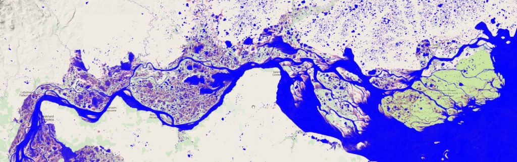
Chapter 3 discusses where to get spatial data: which data sources are currently available? What are the prospects? Where can you get free data? When/why purchase data and which? It introduces Vector data and Raster data and where to get them.
Chapter 4 is about the first steps in approaching spatial data analysis for ecologists: defining the aim, first assessment of available data, creating an archive, options and challenges, and defining ecological requirements: special, spectral, temporal resolution, extent and projections.
Chapter 5 explains the necessary initial preprocessing steps: projections and transformations, data conversion, data formats, corrections, stretching methods, spatial masking and others.
Chapter 6 is about how to sample field data for remote sensing data analysis: what to measure and why measure it? It discusses the importance of efficient sampling strategies, GPS handling, remote sensing and in-situ data measurements, land cover field data sampling approaches (e.g. Land Cover Classification System (LCCS)), further relevant measurements, collecting on-screen training data from GoogleEarth/Bing or aerial imagery etc. using QGIS, and importing/exporting to analysis software.
Chapter 7 introduces approaches to extract spectral information and discusses principles and comparisons. Well-established spectral indices such as the NDVI will be introduced and, additionally, further relevant indices such as the MSAVI, EVI and transformation approaches will be covered.
Chapter 8 explains how to conduct image classification: classification principles, classification types (un-supervised and supervised approaches), and usage in real-world examples: landcover vs. landuse classification will be discussed, as well as practical examples of collecting training samples, generating a landcover classification using R, evaluating a landcover classification (accuracy assessment, statistics) and accuracy assessment of classification results.
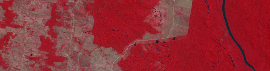
Chapter 9 discusses land cover change (change detection) and various change detection methods that can be accomplished with available open source tools. Land cover change maps will be created using methods in R and you will be shown how to map the results.
Chapter 10 describes continuous land cover information: generating a continuous vegetation map; discussing its disadvantages and advantages and potential errors.
Chapter 11 goes into depth on time-series analysis. In this chapter time-series data such as MODIS and AVHRR will be used to derive phenological metrics, analyse temporal breakpoints using R and GRASS and discuss how these results can be used in ecological research.
Chapter 12 is dedicated to spatial land cover metrics (texture). Using R and GRASS various spatial metrics will be described and discussed for their ecological relevance. The underlying principle will be introduced and various methods applied.
Chapter 13 describes spatial statistics and predictions of point data: it introduces spatial statistics and modelling, the added value to biodiversity research and discusses analysis and interpretation of results.
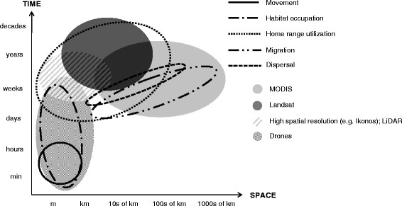
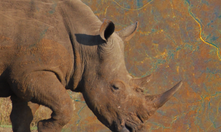
Chapter 14 is about the added value of remote sensing for animal movement analysis: tracking data (GPS/Telemetry), challenges and opportunities and basic examples of using tracking data will be covered and selected methods will be applied.
All practical examples in this book rely on OpenSource software and freely available data sets. Quantum GIS (QGIS) is introduced for basic GIS data handling, and in-depth spatial analytics and statistics are conducted with the software packages R and GRASS.
Readers will learn how to apply remote sensing within ecological research projects, how to approach spatial data sampling and how to interpret remote sensing derived products. The authors discuss a wide range of statistical analyses with regard to satellite data as well as specialised topics such as time-series analysis. Extended scripts on how to create professional looking maps and graphics are also provided.
This book is a valuable resource for students and scientists in the fields of conservation and ecology interested in learning how to get started in applying remote sensing in ecological research and conservation planning.
– See more at: http://book.ecosens.org