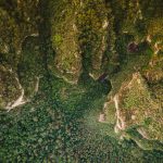
The Ecoinformatics and Biodiversity of Aarhus University, together with the Dept. of Geodesy and Geoinformation of TU Vienna is organizing a summer school on “Airborne LIDAR for Ecology”.
Airborne LIDAR has become the second most widespread airborne remote sensing technique after aerial photography, with many European countries and large areas of the US and Canada, but also many tropical sites of ecological interest having full data coverage or even several repeated surveys. LIDAR delivers sub-meter resolution three-dimensional models of terrain and vegetation together, and has been successfully used for habitat quality assessment, ecosystem service quantification and biodiversity modelling in a wide variety of locations and habitats. The course is designed to enable ecologists with some knowledge of basic GIS to understand what can be done with LIDAR, carry out their own data analysis (including terrain and surface modelling, vegetation classification, single tree detection, species richness modelling and more) and apply the results to ecological studies.
more details here: http://phd.au.dk/gradschools/scienceandtechnology/courses/scientific-courses/kurser-2018/bioscience/airborne-lidar-for-ecology-2018/
