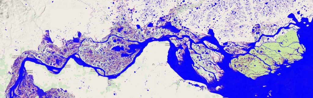
EU-JRC released and published a Global Surface Dynamics data set based on over three million satellite scenes between 1984 and 2015. This global map is available in 30-meter resolution. The maps are available for all users, free of charge. It provides information about water occurence or water seasonality on a global scale since 1984.
An interactive globe for browsing the data and its information can be accessed here:
https://global-surface-water.appspot.com
the main webpage by EU-JRC about this remote sensing products can be seen here:
https://ec.europa.eu/jrc/en/news/mapping-long-term-global-surface-water-occurrence