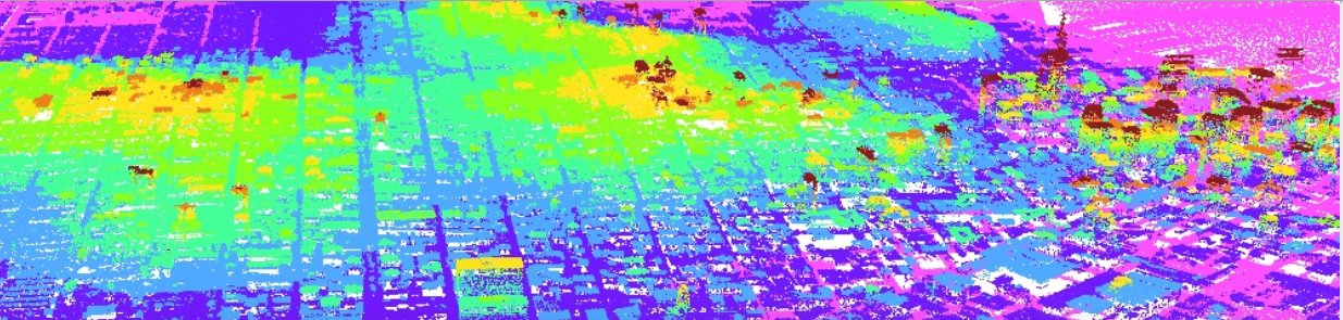
 This repository contains U.S. topographic data using a variety of Lidar sensors for a high diversity of applications across several years since 1996 – data can be viewed and downloaded from https://coast.noaa.gov/dataregistry/search/collection/info/coastallidar – moreover links for training opportunities are offered as well as example applications.
US coastal Lidar data