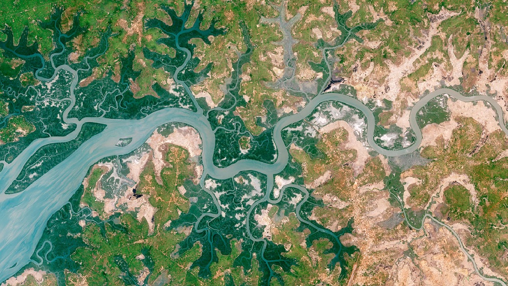
This new paper by Pickens et al. (2020) uses all Landsat scenes from 1999 to 2018 and performs a time-series analysis to map and track changes in open inland surface water dynamics on a global scale. The results reveal that the area experiencing recurring change between land and water states is greater than area undergoing either a gain or loss of surface water. For more information, have a look at the abstract below or read the full article to discover more about their approach (e.g. measurement of associated uncertainties).
” Global surface water extent is changing due to natural processes as well as anthropogenic drivers such as reservoir construction and conversion of wetlands to agriculture. However, the extent and change of global inland surface water are not well quantified. To address this, we classified land and water in all 3.4 million Landsat 5, 7, and 8 scenes from 1999 to 2018 and performed a time-series analysis to produce maps that characterize inter-annual and intra-annual open surface water dynamics. We also used a probability sample and reference time-series classification of land and water for 1999–2018 to provide unbiased estimators of area of stable and dynamic surface water extent and to assess the accuracy of the surface water maps. From the reference sample data, we estimate that permanent surface water covers 2.93 (standard error ±0.09) million km2, and during this time period an estimated 138,011 (±28,163) km2 underwent only gain of surface water, over double the estimated 53,154 (±10,883) km2 that underwent only loss of surface water. The estimated area of 950,719 (±104,034) km2 that experienced recurring change between land and water states is far greater than the area undergoing these unidirectional trends. From a probability sample of high resolution imagery, an estimated 10.9% (±1.9%) of global inland surface water is within mixed pixels at Landsat resolution indicating that monitoring of surface water changes requires improved spatial detail. We provide the first unbiased area estimators of open surface water extent and its changes with associated uncertainties and illustrate the challenges of tracking changes in surface water area using medium spatial and temporal resolution data.”
Pickens, A. H., Hansen, M. C., Hancher, M., Stehman, S. V., Tyukavina, A., Potapov, P., Marroquin, B., Sherani, Z. (2020). Mapping and sampling to characterize global inland water dynamics from 1999 to 2018 with full Landsat time-series. Remote Sensing of Environment, 243(March), 111792. https://doi.org/10.1016/j.rse.2020.111792