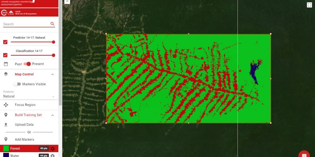
The IUCN Red List of Ecosystems initiative has recently developed an online remote sensing app (https://remap-app.org) for making maps of ecosystems, landcover and land change with freely available satellite data.
Remap’s development was funded by Google in an effort to make land cover mapping quick and accessible to everyone. In particular, Nick Murray and colleagues wanted to get users with little background in remote sensing making high quality maps to support ecosystem monitoring programs and conservation, with:
– No need to download spatial data
– No need to think about remote sensing classification methods
– Users simply need to develop a training dataset interactively or by uploading their own data
– Quantify the area of each ecosystem class, area change (from 2000 to 2017)
– Download a GeoTIFF of the classified map
For more info go to the website, launch the app and work your way through the quick-start guide (https://remap-app.org/tutorials).
Also see the preprint paper describing remap in detail (https://www.biorxiv.org/content/early/2017/11/01/212464).
Feel free to get in touch with Nick directly if you want to know more about it (n.murray@unsw.edu.au)