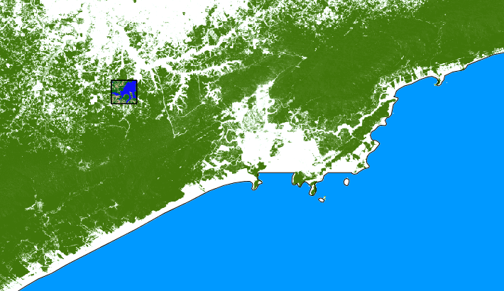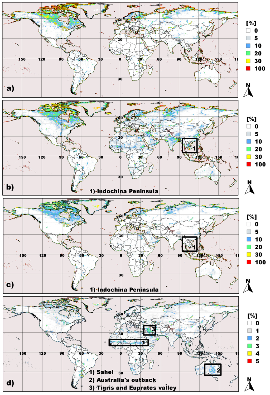
 an interesting article about fractional surface water mapping just got published in Remote Sensing. The abstract of the article “Development and Evaluation of a Multi-Year Fractional Surface Water Data Set Derived from Active/Passive Microwave Remote Sensing Data” reads: The sensitivity of Earth’s wetlands to observed shifts in global precipitation and temperature patterns and their ability to produce large quantities of methane gas are key global change questions. We present a microwave satellite-based approach for mapping fractional surface water (FW) globally at 25-km resolution. The approach employs a land cover-supported, atmospherically-corrected dynamic mixture model applied to 20+ years (1992–2013) of combined, daily, passive/active microwave remote sensing data. The resulting product, known as Surface WAter Microwave Product Series (SWAMPS), shows strong microwave sensitivity to sub-grid scale open water and inundated wetlands comprising open plant canopies. SWAMPS’ FW compares favorably (R2 = 91%–94%) with higher-resolution, global-scale maps of open water from MODIS and SRTM-MOD44W. Correspondence of SWAMPS with open water and wetland products from satellite SAR in Alaska and the Amazon deteriorates when exposed wetlands or inundated forests captured by the SAR products were added to the open water fraction reflecting SWAMPS’ inability to detect water underneath the soil surface or beneath closed forest canopies. Except for a brief period of drying during the first 4 years of observation, the inundation extent for the global domain excluding the coast was largely stable. Regionally, inundation in North America is advancing while inundation is on the retreat in Tropical Africa and North Eurasia. SWAMPS provides a consistent and long-term global record of daily FW dynamics, with documented accuracies suitable for hydrologic assessment and global change-related investigations.