Webinars on Supporting Implementation of the Post-2020 Global Biodiversity Framework
A series of regional webinars to support the implementation of the Post-2020 Global Biodiversity Framework (GBF) will start next week, precisely on 28 June 2021. The series aims at "increase the understanding of the monitoring framework of the post 2020 Global...
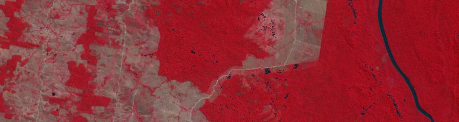
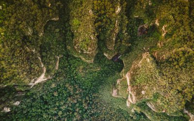
In light of the International Day of Forests: Earth Observation Based Monitoring of Forests in Germany – A Review
Today – 21st of March - is the International Day of Forests! Now, what other day would be better suited to take some time off and to dive into some articles and news on our precious forests? So, if you have some spare time, I would recommend grabbing a cup of coffee...
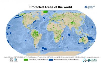
New Version of the Management Effectiveness Tracking Tool: METT-4
For those of you actively involved in tracking and reporting on the progress towards the effectiveness of protected area management and conservation targets or simply interested in this topic it may be nice news that a new version of the Management Effectiveness...
Various Scientific Project Officer Positions at JRC
The European Commission's in-house science service, the Joint Research Centre (JRC), is offering a number of interesting (scientific) officer positions. Particularly two positions have caught my attention: A position within a project that uses Earth Observation and...
PHD POSITION ON Determining the Effectiveness of Different Conservation Area Types for Meeting Global Biodiversity Targets
Professor Bob Smith is offering an interesting PhD studentship focusing on the collection of spatial data on non-state conservation area types at the School of Anthropology and Conservation – DICE (University of Kent). The PhD researcher will strengthen and refine a...
Open call for the nomination of the GEO BON co-chair
GEO BON has opened a nomination process for its co-chair that will serve a mandate of at least 3 years together with Andrew Gonzalez (QCBS and McGill University). Together with the announcement of the relocation of GEO BON's headquarters from Leipzig, Germany, to...
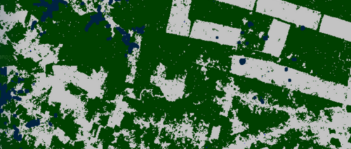
Forest Health using remote sensing
A new publication on forest health monitoring got published in Remote Sensing. From the abstract: “Forest ecosystems fulfill a whole host of ecosystem functions that are essential for life on our planet. However, an unprecedented level of anthropogenic influences is...
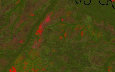
New free WWF guidelines on satellite remote sensing for conservation released
WWF-UK just released free guidelines to support practitioners and scientists interested in using satellite remote sensing data to inform their project or support the management of their landscape. This latest chapter in the Conservation Technology Series, co-authored...
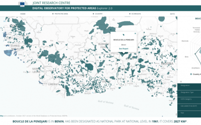
DOPA – the most advanced global information system on protected areas.
The Joint Research Centre (JRC) of the European Commission has launched the second version of the free DOPA Explorer, the most advanced global information system characterising the world’s protected areas. DOPA Explorer 2.0, as part of the JRC's Digital Observatory...
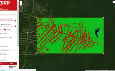
Remap – an online remote sensing app for making maps of ecosystems & landcover
The IUCN Red List of Ecosystems initiative has recently developed an online remote sensing app (https://remap-app.org) for making maps of ecosystems, landcover and land change with freely available satellite data. Remap's development was funded by Google in an effort...
Martin Wegmann is based at the remote sensing department of Prof. S. Dech, head of DLR-DFD (German Aerospace Data Center) in Würzburg where he leads the Remote Sensing and Biodiversity research topic. Moreover he is an assistant professor at the Global Change Ecology M.Sc. Program and the point of contact for the CEOS Biodiversity initiative, which aims at coordinating space borne activities for biodiversity and conservation related activities. Moreover he is on the steering committee of the Conservation Remote Sensing group, advisory board of the EU BON project and Implementation Committee in GEO BON.
In his courses the theoretical background as well as the practical implementation of remote sensing for biodiversity research and conservation application are taught. The remote sensing data analysis as well as the integration with biodiversity data and the spatial statistics including spatial modelling are mainly done with OpenSource software such as R and GRASS. The majority of courses are done within the Global Change Ecology MSc. program but other courses have been done in Würzburg as well as in different locations in West Africa.
The added value of spatial and temporal variable environmental data sets for corresponding biodiversity modelling approaches are in the focus of his work. Especially the spatial arrangement of landcover and its implication for spatial biodiversity patterns based on remotely sensed information interests him. Most of his work has been done in Europe and Africa.
infos
doing stuff
- R since 2002
- GRASS since 2002
- Linux since 2002
- name
- name
- OpenSource usage 90%
- 0%
My Recent Work
portfolio